
Professional Land Surveying, Property Valuation & Environmental Planning & Management Services
A multidisciplinary consultancy firm offering specialized services in Land & Engineering surveying, Property Valuation, GIS & Mapping, Environmental Impact Assessment, Land Acquisition and Resettlement, and RAP consultancy in Kenya and the East Africa region. With 10 years of professional experience.

Our Services & Solutions
Comprehensive land surveying, valuation, and environmental services tailored to meet your specific needs
1. Services
Core professional services we provide
1. Land Surveying
We provide precise and legally compliant surveying services essential for planning, design, and construction.
- Cadastral & Boundary Surveys
- Engineering & Topographical Surveys
- Geodetic Control Surveys
- As-Built & Setting-Out Surveys
- Subsurface Utility Mapping (GPR Surveys)
2. Property Valuation
Our registered valuers deliver timely, professional valuations for diverse purposes, adhering to the highest industry standards.
- Secured Lending & Financial Reporting
- Insurance, Sale, and Purchase Valuations
- Compensation and Litigation Support
- Asset Valuation for Land, Buildings, Plant & Machinery
3. Environmental Planning & Management
Expert guidance to ensure development projects are environmentally and socially sound, aligning with ecological integrity, regulatory compliance and long-term sustainability goals.
- Environmental Impact Assessment (EIA)
- Environmental Compliance and Auditing
- RAP/ESIA Studies
- Land Use & Spatial Planning
4. GIS & Land Acquisition Services
We transform geographic data into actionable intelligence and manage the sensitive process of land acquisition with a focus on social sustainability.
GIS & Mapping
- Spatial Data Acquisition & Analysis
- Customized Mapping Solutions
- Geodatabase Design & Development
Land Acquisition & RAP
- Land Acquisition & Resettlement Action Plans
- Comprehensive Spatial Reporting
- Stakeholder & Community Engagement
5. Survey Equipment Hire
Professional survey equipment available for hire at affordable rates, including RTK GPS, Total Stations, Digital Levels, and specialized surveying accessories for your project needs.
2. Solutions
Specialized solutions tailored to your project needs
Topographic Survey
Detailed topographic mapping and terrain analysis
Underground Utility Mapping Solutions
Comprehensive underground utility detection and mapping
Infrastructure Corridor Acquisition Solutions
Land acquisition services for infrastructure development
Sustainable Development & Compliance Solutions
Environmental compliance and sustainable development consulting
Environmental Impact Assessment/Audit Solutions
Comprehensive EIA and environmental auditing services
Property & Asset Valuation Reports
Detailed valuation reports for properties and assets
Resettlement & Compensation Solutions
Resettlement planning and compensation assessment services
GIS & Mapping Solutions
Comprehensive GIS development and mapping services
About LANDEV Consultants Ltd
LANDEV Consultants Ltd is a premier multidisciplinary consultancy firm based in Kenya, serving the broader East Africa region. Since our inception in 2013, we have built over a decade of expertise delivering specialized services in Land & Engineering Surveying, Property Valuation, GIS & Mapping, and Environmental & Social Impact Assessment (ESIA), including Land Acquisition and Resettlement Action Plan (RAP) consultancy.
Our business model integrates modern, technologically advanced methods with the vast experience of our in-house specialists and a dedicated network of external consultants. This collaborative approach ensures we provide comprehensive, high-quality solutions from project conception to successful completion.
“It is only when we measure and traverse uncharted territories that we discover our true potential”
State-of-the-Art Technology
GPS, total stations, and GIS software for precise measurements
Comprehensive Services
From boundary surveys to complex engineering projects
Our Goal, Mission & Vision
Vision
To be the leading provider of accurate, efficient, and innovative professional services in land surveying, environmental planning, property valuation, and geospatial solutions across East Africa.
Mission
To deliver exceptional, client-focused consultancy services in land development, engineering surveying, valuation, and environmental management, driving sustainable and compliant project outcomes throughout Kenya and the East African region.
Goal
To provide the most economical services without compromising on quality, accuracy, or timeliness. We are committed to building strong, lasting client relationships through reliability, credibility, and unwavering focus on client satisfaction as the ultimate measure of our success.
Recent Projects
Showcasing our expertise across residential, commercial, and industrial surveying projects throughout Kenya
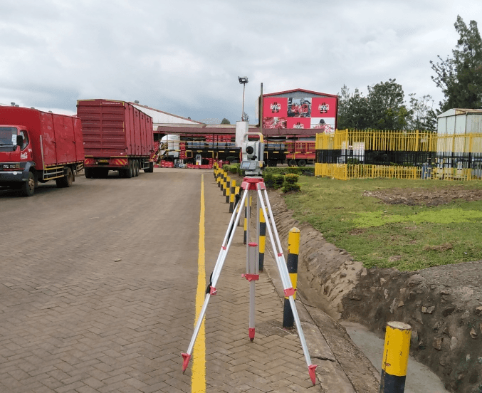
Equator Bottlers Limited
Kisumu - Waste Water Treatment Plant Upgrade
Detailed topographical survey and utility mapping for the waste water system upgrade. Careful planning ensured minimal disruption to operations.
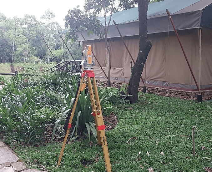
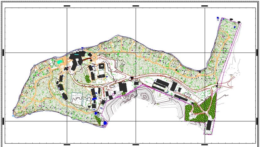
Fairmont Mount Kenya Safari Club
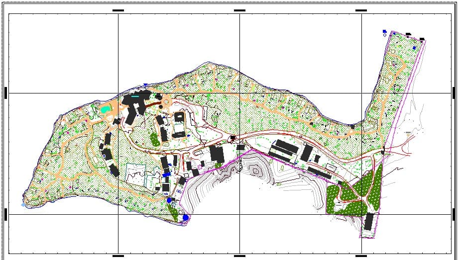
Master Plan Development Survey
Detail survey for master plan preparation. Involved vertical and horizontal control survey and cadastral boundary confirmation.
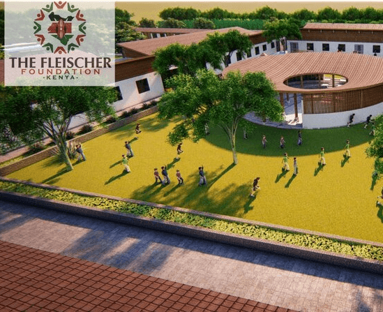
The Fletcher School
The Fleischer Foundation High School Project
Detailed Topographical & Engineering Survey for Architectural design and master planning, 3D modelling and Volumetric computations and analysis
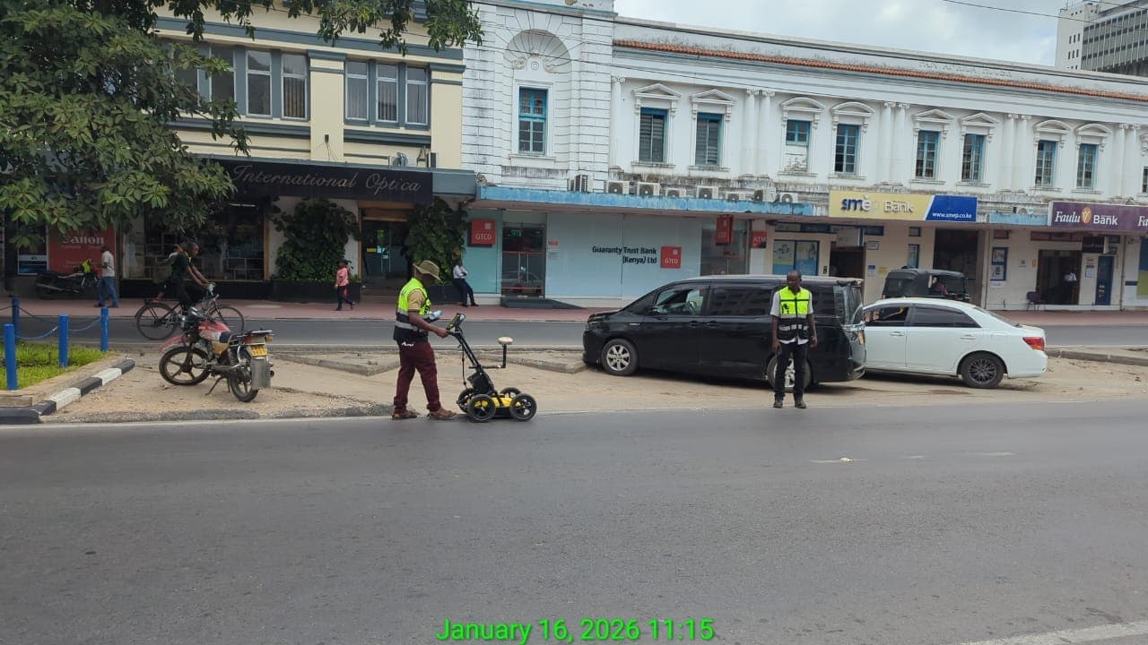
Telkom House Mombasa
Proposed New Data Centre Project
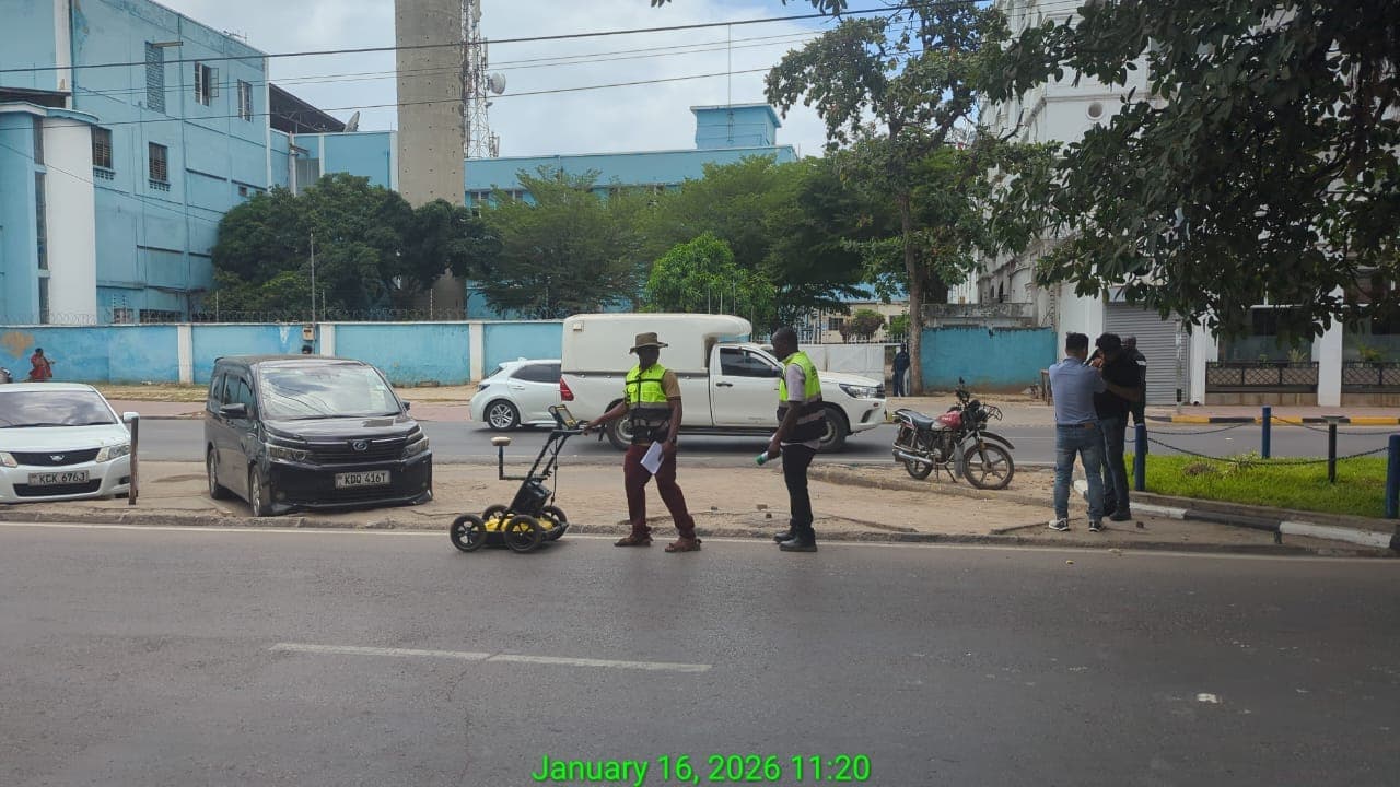
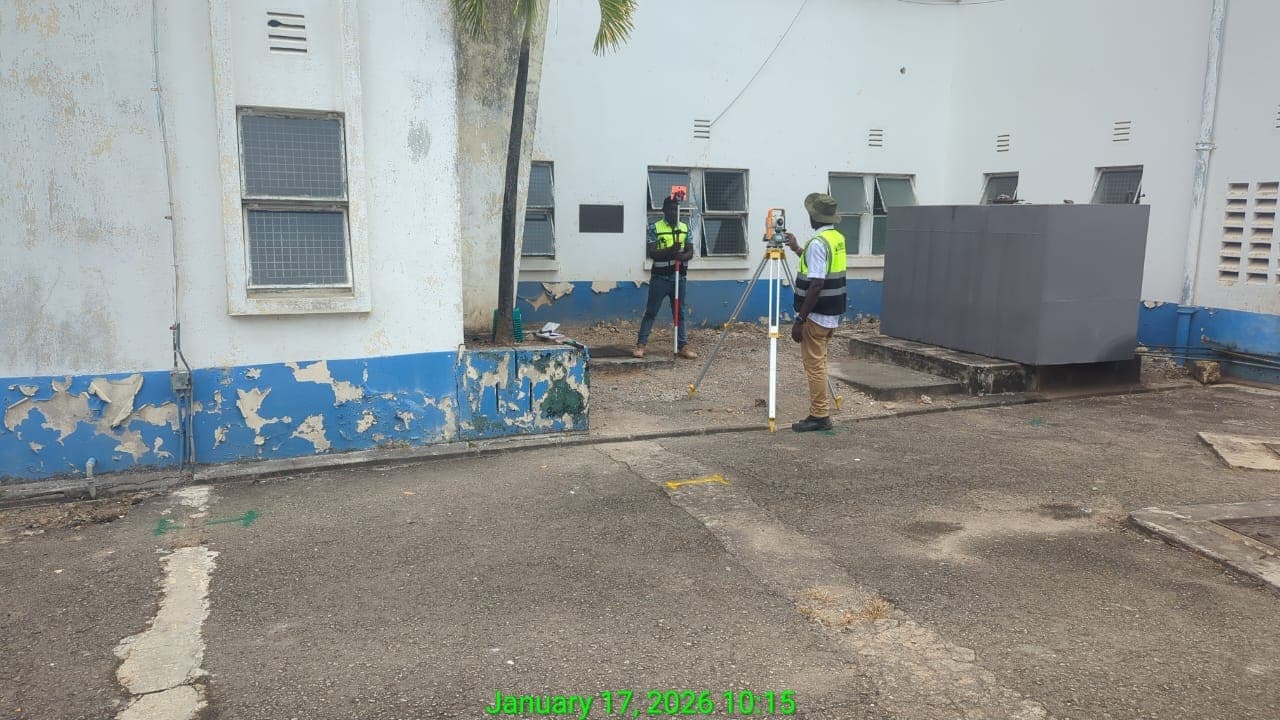
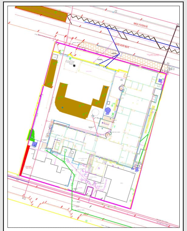
Detailed Topographical and Underground Utility Mapping for Architectural and Engineering Design for the Proposed New Data Centre in Mombasa
Coca-Cola Beverages Africa
Facility Masterplan Upgrade
Detailed topographical survey and utility mapping for facility masterplan upgrades across the plant.
Ilimukuyu Dam & Water Project
Phase II — Dam Design & Construction
Comprehensive topographical and geodetic survey for dam design and construction, ensuring accurate planning and execution.
Bahati Ridge Development Ltd
Residential Housing Development
Cadastral, boundary, and control survey for a residential housing development masterplan.
New Southern Energy (NSE)
Magadi Soda Company — Solar PV Plant
Setting out survey of a 5MW solar photovoltaic (PV) plant and a first-of-its-kind electric calciner at Magadi Soda Company.

nxtra by Airtel AFRICA
Tatu City — Data Centre Development
Detailed topo-cadastral survey for building design and construction within Tatu City.
Share Your Experience
We value your feedback. Please share your experience with our services
Our Partners & Clients
Trusted by leading organizations and institutions across Kenya








Get In Touch
Ready to discuss your surveying or valuation needs? Contact us today for a free consultation.
Visit Our Office
First Floor, Suite 14, Uganda House
P.O. Box 8546-00200
Nairobi, Kenya
Call Us
Email Us
landevconsult@gmail.com
Business Hours
Monday - Friday: 8:00 AM - 6:00 PM
Saturday: 9:00 AM - 4:00 PM
Sunday: Closed
Ready to Get Started?
Contact us today for a free consultation and quote for your surveying or valuation needs across Kenya.
Resources & Insights
Stay informed with the latest industry insights, surveying guides, and property valuation tips
Understanding Boundary Surveys
Learn about the importance of boundary surveys for property ownership, development planning, and legal protection.
Read More →Property Valuation Methods
Discover the different approaches to property valuation and how they affect market value assessments and investment decisions.
Read More →Modern Surveying Technology
Explore how GPS, total stations, and GIS technology are revolutionizing the field of land surveying and mapping.
Read More →